By Dr. Steven Hamburg, Chief Scientist at EDF and MethaneSAT Project Lead
Methane has taken center stage in the race for climate solutions, creating a growing demand from regulators, industry and other stakeholders for more and better emissions data – how much methane is coming from where, who’s responsible, and are those emissions going up or down over time? With MethaneSAT, we will see the answers as never before.
New methane regulations issued last year in the United States and European Union set tighter limits on emissions for oil and gas producers. Meanwhile, corporate commitments to address methane reached new heights at COP 28, where 50 oil and gas companies that represent over 40% of global oil production pledged to reduce emissions to near zero and to eliminate routine flaring by 2030.
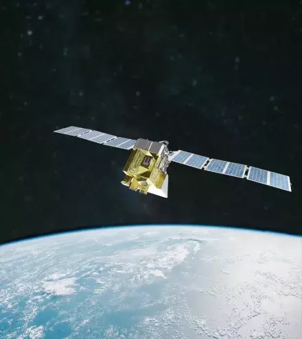
But fulfilling these pledges and reducing emissions at the scale we need to achieve climate progress will require a clear and transparent way to accurately account for methane emissions worldwide. That’s the vision behind MethaneSAT, which, after six years in development, was launched aboard a SpaceX Falcon 9 rocket on March 4, 2024
Unrivaled Capabilities
MethaneSAT isn’t the only methane-detecting satellite in orbit, but it will fill a critical data gap and strengthen the overall satellite ecosystem.
Among existing satellites, some can provide high-resolution data for specific, pre-targeted sites.
These are particularly helpful for operators trying to mitigate larger leaks or monitoring leak-prone areas. Others collect emissions data over very large areas and detect large emitting events, but can’t see emissions from smaller sources that account for the majority of emissions in many, if not most, regions. See how they compare.
It is essential for regulators and companies to identify, quantify and fix large leaks – so-called super emitters. But we can’t quantify the methane emissions for global oil and gas production or verify any reductions if we can’t accurately measure total emissions from all sources – large and small, alike, by tracking differences in methane concentrations as small as 3 parts per billion.
The revolution of MethaneSAT is its ability to precisely measure methane levels with high spatial resolution over wide areas, allowing it to track all methane escaping from the production of oil and gas, including smaller, diffuse sources that account for most emissions in many regions – data essential to determine emission rates from a given geography.
In addition to identifying emission sources and rates for a given region, MethaneSAT will allow us to compare emissions across major oil and gas basins around the world and track how they change over time at the sub-basin, basin, country or global scales. Moreover, the analytics developed specially for the mission will trace those emissions back to their source/source area within those target regions.
MethaneSAT’s wide-camera view is designed to survey large areas – for instance, the Permian Basin in New Mexico and Texas, or whole states or countries. That gives us the ability to effectively quantify total methane emissions for wide regions that have, until now, hidden in plain sight and separate emissions from different sectors based on their spatial distribution. This enhanced resolution and precision provides crucial data we simply don’t have today and can be used by other satellite operators to pinpoint high-emitting regions that require further examination.
Seeing is Believing
Another key component of MethaneSAT is making its data publicly available so society can keep governments and companies honest in delivering on their methane promises. Anyone on the planet will be able to access MethaneSAT data online, and companies, investors and government officials can arrange for custom datasets to start or supplement their own emission data tracking efforts.
Environmental Defense Fund has engaged with regulators, oil and gas operators, asset managers, and other advocates to explain the value of MethaneSAT data to reduce methane emissions, help companies and countries meet methane targets, and provide a level of transparency the public needs to hold everyone accountable.
The International Energy Agency and the UN Environment Programme both plan to use MethaneSAT data in their global integrated data products and analyses. These data will be ideally suited to help US EPA, the European Commission, and other countries and regions design and implement regulatory methane programs.
It will also be a valuable resource for major gas importing countries who are increasingly concerned about the threat upstream methane emissions pose to their climate strategies. They’ll be able to compare suppliers’ methane performance and more accurately calculate how gas imports help or hurt their carbon reduction efforts.
MethaneSAT will also play a central role in a watchdog effort backed by Bloomberg Philanthropies to create independent accountability against the methane commitments major oil and gas companies made at COP 28.
Age of Accountability
For more than a decade, EDF has used cutting-edge methane emissions data from ground-based and airborne sensors. Collectively, the studies we helped coordinate have shown that far more methane is escaping from oil and gas infrastructure than countries or companies suspected. Analysis shows that reducing these harmful emissions is the quickest and most affordable way to slow the rate of warming in the near term.
2024 marks the start of a new era of radical transparency in greenhouse gas measurement and, with it, accountability, and action to rapidly reduce methane emissions. We designed MethaneSAT – from its technical specs, its groundbreaking data analytics and processing system, and commitment to public and transparent data access – specifically to catalyze that action.

