
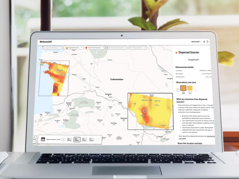
Analyze, Compare and Act
Compare emissions across different areas, monitor how emissions change and deploy solutions that achieve maximum reductions.

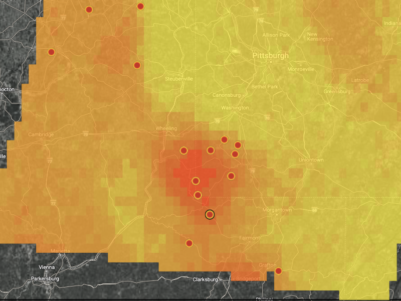
Unmatched Accuracy and Precision
Advanced sensing technology detects methane emissions across the globe with unprecedented resolution and precision.
Fast, Free Transparent Data
MethaneSAT data is available online for free, ushering in a new era of climate transparency and accountability.


